


The road through the Caprivi stretches nearly 500 kilometers, a long ribbon of tarmac threading through the far northeast of Namibia. At either end, small villages of thatched huts or simple homes are spread along the road, marking the start and finish of the journey. Between them, national parks with plains and scattered groves of trees, through quiet stretches where the horizon seems endless. The details of the strip reveal themselves slowly —scattered structures, then tall grass swaying in the wind, the occasional movement of wildlife and always the shimmer of heat rising from the road. It is a drive that feels both expansive and intimate, a passage through a landscape measured in space and stillness rather than time.
For travelers coming from the arid vastness of the Namib Desert or the baked red soils of the Kalahari, the Caprivi feels like another world entirely. Trees begin to gather close along the road — mopane, acacia, and jackalberry — and the smell of river mud replaces the dust. Cattle and goats graze in open clearings. Every few miles, a cluster of houses appears: thatched huts set back from the verge, their reed fences marking the edge of family yards. The road itself remains mostly straight, unhurried, but around it the land begins to show signs of motion — people walking with bundles balanced on their heads, a bicycle leaning in the shade, a herd of goats crossing one by one. It is the first sign that the long silence of the west is giving way to the quiet pulse of life that defines the Caprivi.

To understand the Caprivi, you have to step back into a time when maps were drawn not by rivers or ridges, but by negotiations in faraway rooms. The shape of this narrow corridor was the result of political imagination more than geography — a line etched in Europe’s imperial age.

In 1890, Germany and Britain were trading territories like chess pieces in their scramble to divide Africa. Germany, already established in what it called Deutsch-Südwestafrika (German South West Africa), wanted a route to the Zambezi River — a corridor that might one day link the Atlantic Ocean to the Indian Ocean. The dream was a grand one: a continuous German presence across the continent. Britain agreed to the trade in the Heligoland-Zanzibar Treaty, and the Caprivi Strip was born — a narrow ribbon of land, attached to the rest of Namibia almost as an afterthought.
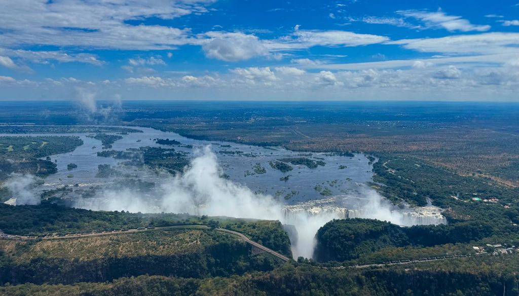
What the Germans found, once they reached it, was not the golden highway they’d imagined. The Zambezi flowed east, but Victoria Falls and the rapids below it made navigation impossible. The corridor was beautiful but impractical — a tangle of rivers, swamps, and malaria-ridden lowlands. The dream of a cross-continental route faded quickly, leaving behind a name — Leo von Caprivi, the German chancellor who signed the deal — and a stretch of land whose destiny was shaped by faraway ambitions.
The early colonial administrators found the Caprivi difficult to control. Its climate was harsh, its rivers flooded unpredictably, and tsetse flies made livestock farming nearly impossible. German authority in the region was thin, more nominal than real. When World War I broke out, South African troops pushed the Germans out, and the region fell under the administration of South Africa — first as a military zone, later as part of the South West Africa mandate under the League of Nations.
The Caprivi’s value, to colonial governments, was not its agriculture or commerce but its position. By the 1960s and ’70s, that position became critical. The liberation wars of southern Africa were burning across borders — in Angola, Zambia, Zimbabwe, and Namibia itself. The South African military saw the Caprivi as a forward base, a place from which to move troops and supplies along the northern frontier. The once-quiet region became militarized: roads widened, small airstrips built, and soldiers stationed along the border.
For the people of the Caprivi, these were years of uncertainty. Borders that had once been fluid became heavily patrolled. Families that had lived for generations along the same stretch of river now found themselves divided by national frontiers. The floodplains that had sustained communities became, for a time, corridors of soldiers and secrecy.
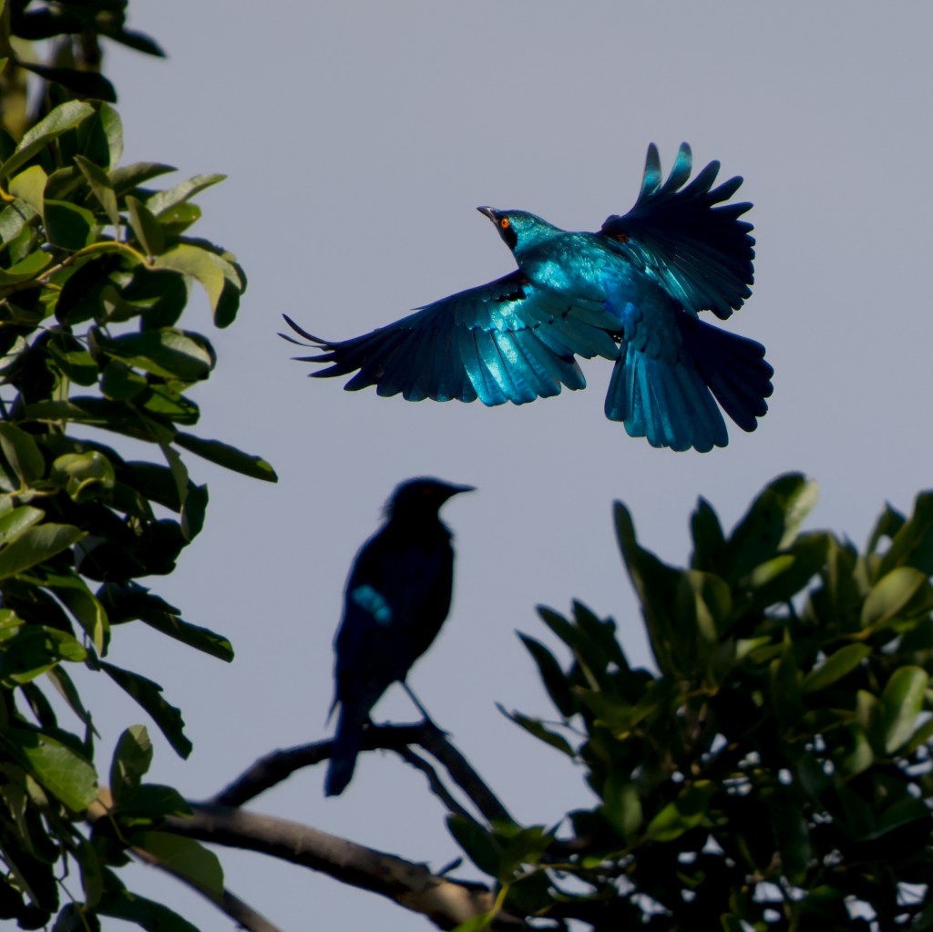
When Namibia gained its independence in 1990, the Caprivi entered a quieter chapter of its long and complicated story. The soldiers slowly withdrew, and the hum of patrol vehicles was replaced by the sounds of the bush — the calls of Starlings in the morning, the distant chatter of villages returning to the rhythm of daily life. Roads that were once built for military use now became lifelines for trade and travel, connecting far-flung communities to the rest of the country.
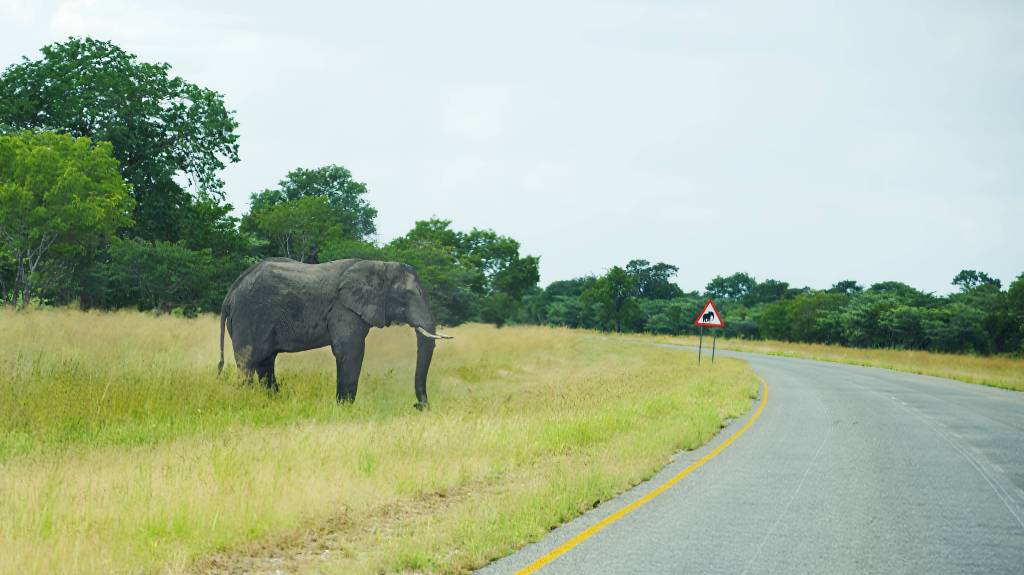
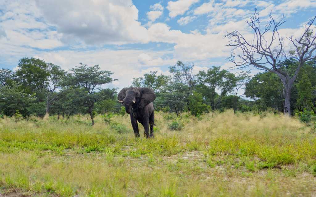
The land began to reclaim itself. Abandoned outposts and airstrips were swallowed by grass and mopane, while the great floodplains along the Kwando and Linyanti breathed again with the annual pulse of the rains. Where the military fences once stood, elephants began to wander freely, crossing back and forth between Namibia, Botswana, and Angola — following the same ancient routes they had long before the borders were drawn.
In many villages, the years since independence have brought a slow, steady transformation along the road. The traditional thatched huts — round, low, and built from reed and mud — still cluster beneath the acacia trees, their golden roofs catching the late light.
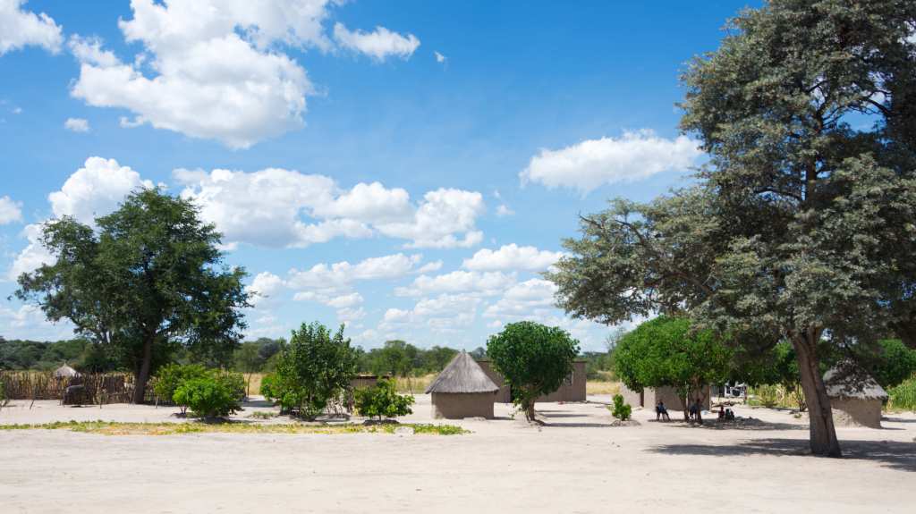
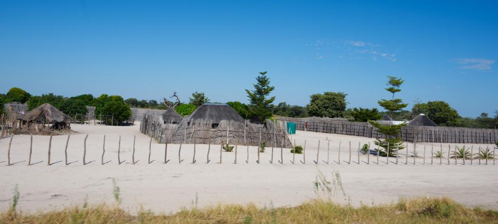
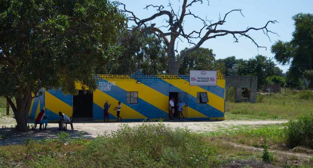
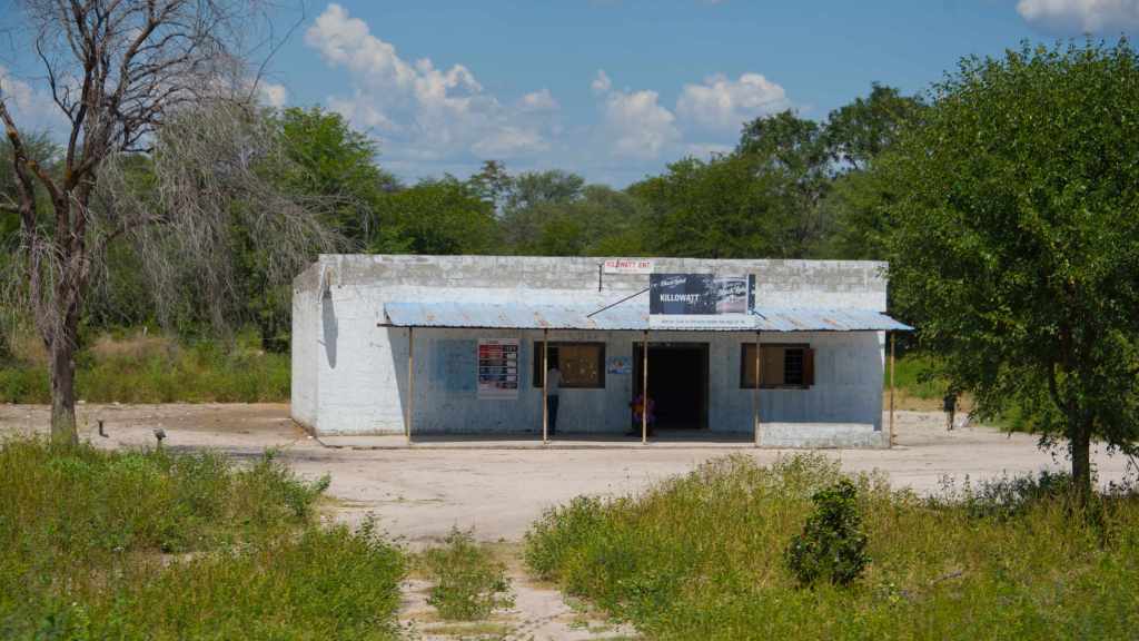
But among them now rise newer buildings: square homes of corrugated metal, their walls gleaming silver in the sun. Some are painted in bright blues and yellows, colors that stand out against the earth, a sign of the small but visible prosperity that has found its way here. Along the roadside, new life hums quietly — the rumble of trucks, the laughter of children walking home from school, the smell of baked bread from a small shop that doubles as a café.

Churches, too, have multiplied — small white or colored buildings with tin roofs that glint beneath the heat, their Sunday bells echoing across the open plains. Schools line the highway, their courtyards filled with the sound of singing assemblies in the mornings, and in the afternoons, groups of children walk in long lines through the dust, uniforms crisp and bright.

Here and there, small general stores have appeared, selling flour, sugar, paraffin, and sometimes even cold drinks kept cool in humming fridges powered by solar panels. It is a landscape where the old and new live side by side — where reed fences still circle homesteads, and yet, beyond them, a network of cell towers and power lines now threads across the plains, carrying a faint hum of modern life through a place that once stood still for decades.
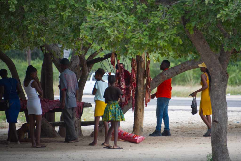
Along the roadside, small markets gather in the shade of great trees where the branches themselves become part of the stalls. Tables are laid out beneath them, covered with neatly stacked produce — oranges, tomatoes, melons — while from the branches meat is hung ready to become the evening meal. People gather in clusters, laughing and talking, their clothing vivid against the soft tones of the earth — reds, yellows, blues catching the light as they move from table to table.
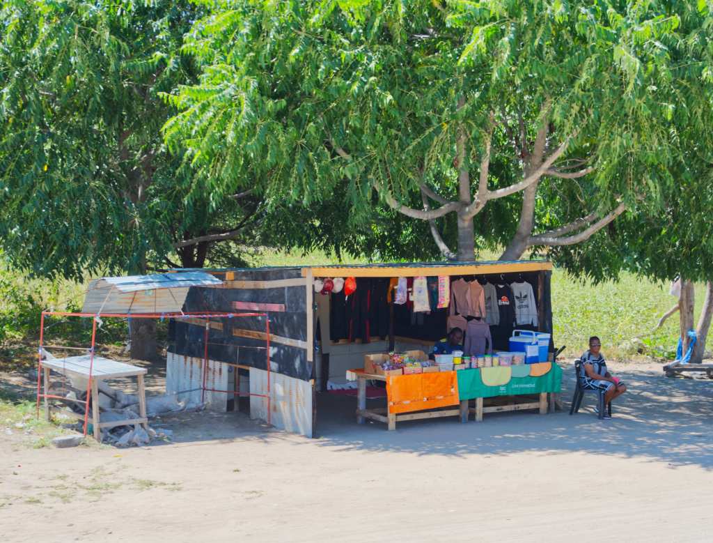
Further down the road stands a small lean-to, its roof of tin sheets held down with stones, the walls little more than poles and bits of fabric tied against the wind. Inside, a wooden table holds neat rows of sweets in plastic bins, packets of biscuits, and small piles of folded clothing — bright shirts, scarves, and hats that catch the light as the breeze moves through. A hand-painted sign leans against one post, faded but cheerful, and behind the counter, the shopkeeper sits quietly, greeting travelers with an easy smile. The place feels temporary, yet enduring — a small pause of color and life against the long stretch of road. The scene feels both timeless and full of motion, a reflection of how the old ways of trade have simply adapted to the new roads that now run through this land.
There are long stretches where the road runs through open parkland, and the villages fall away entirely. The land widens into silence — miles of tall grass and scattered trees, the bush dense in places and open in others, giving sudden glimpses of antelope or elephants moving through the heat shimmer. The air feels heavier here, the colors deeper, the sense of distance greater. The road cuts straight through the wilderness, flanked by nothing but the sound of wind and the hum of insects, a reminder of how much of the Caprivi still belongs entirely to the wild.
As the miles unfold, the rhythm of the road becomes steady, almost meditative. The world moves at its own quiet pace — a woman walking with a basket balanced on her head, a child waving from the shade of a tree, a man on a bicycle gliding along the edge of the tarmac. The villages come and go, scattered and self-contained, their thatched roofs and tin walls catching the light as you pass. Between them lie stretches of parkland, where the bush grows thick again and the land feels untamed. In these places, the wild has returned — elephant tracks pressed deep into the sand, antelope grazing at the edge of the trees, the faint movement of life reclaiming old ground.
In the end, the Caprivi leaves its mark not through grandeur but through its quiet continuity. The road, the plains, the people, and the wildlife all seem bound by a rhythm older than memory — a balance slowly restored. For travelers, it lingers long after the journey ends, in the stillness of the grass, the distant call of birds, and the calm persistence of the land that endures beyond sight.

Leave a comment